Britannia Archaeology Ltd Services
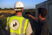
Consultancy and Advice
Britannia Archaeology offer advice to clients on the likely impact of their development to the archaeological heritage. Our team can advise at every stage of a project, guiding you through the planning and development control process and liasing with Local Planning Authorities and County Archaeologists on your behalf.
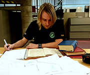
Desk Based Assessment
Desk-Based Assessments (DBAs) are often the first stage of archaeological investigation associated with a proposed development. Our team produce DBA's which involves collating all existing information about a proposed development site. This information is carefully analysed and the potential presence of archaeology is assessed. The likely impact of the development on the cultural remains is then outlined and discussed. Sources of information include historic maps and documents, previous archaeological reports, information held in archaeological databases, air photographs and geotechnical surveys. The assessment can then be used to guide decisions about how the archaeology will be dealt with before and during development.

Environmental Impact Assessment
Environmental Impact Assessments (EIAs) comprise the collation of reports from different disciplines to assess the overall environmental impacts of a proposed development. Britannia Archaeology’s staff are well-rehearsed in producing the archaeological chapters for EIAs. These outline the likely impacts of a proposed development on cultural heritage and the historic environment in its broadest sense.
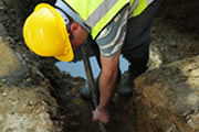
Watching Briefs
Watching briefs are usually undertaken on sites with relatively low archaeological potential. A member of our team observes all groundworks while causing as little disruption to the developer as possible. Archaeological features including any modern disturbance are recorded and a report is produced outlining the findings. Our team operates out of the Stowmarket office.
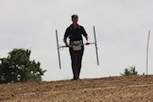
Geophysical Survey
Our in-house team carry out geophysical surveys throughout East Anglia. Geophysical prospection is a non-intrusive technique used to investigate archaeology below the topsoil without causing damage. There are many different methods which are suitable on various geologies. The instruments record subtle differences in the soil and the resulting datasets are then used to produce a digital plan of subsurface archaeological features, accompanied by an interpretative report. Geophysics is used as a primary investigative method and can be used to target evaluation trenches. Our team conduct fluxgate gradiometry, caesium magnetometry, magnetic susceptibility and earth resistance surveys from our Stowmarket office.
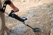
Fieldwalking and Metal Detecting
Archaeologists walk along a surveyed grid set out on a recently-ploughed or harrowed field to recover and record archaeological finds present in the topsoil. The finds are then identified, spot-dated and recorded on a digital plan. Britannia Archaeology Ltd produce a report exploring chronological and typological trends within the finds assemblage. This is a useful investigative method in arable areas (such as East Anglia), helping to target evaluation trenches on areas of archaeological potential within a proposed development site.
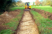
Trial Trench Evaluations
Trial trench evaluations are a primary investigative tool. Our team target linear trenches over cropmarks, geophysical anomalies or concentrations of finds identified through fieldwalking. Alternatively, trenches are laid out evenly to provide a representative sample of a development site’s total area. If archaeology is present, a larger open area excavation may be required. A detailed report on the findings is produced, which can be used to guide decision-making regarding proposed development layouts or archaeological mitigation strategies.
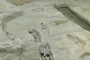
Excavation and Strip, Map and Record
Open area excavation is the most intensive form of archaeological investigation. An area is stripped of topsoil and overburden by machine to the first archaeological horizon and then all archaeological features are carefully excavated and recorded. Britannia Archaeology produce a report of the findings that may lead to publication in a local archaeological journal, or as a monograph, depending on the site's importance.
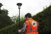
Topographic Survey
Topographic surveys accurately record all surviving above-ground remains on a site using global positioning systems (GPS) or a Total Station. The data-sets are then used to produce a sub-centimetre-accurate digital map tied into the Ordnance Survey National Grid. An accompanying report describes and interprets the physical remains.
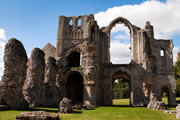
Historic Building Recording
Historic Building Recording (HBR) involves compiling a complete record of a building’s evolution over time, highlighting and recording features of historic and architectural interest. They are often carried out in advance of developments involving Listed Buildings or buildings within Conservation Areas, although they may also be conducted on behalf of private clients who wish to know more about the history of their own homes. Experienced buildings archaeologists carefully illustrate and photograph the structure’s surviving physical fabric and conduct cartographic and documentary research into its history. A comprehensive report is then produced for the client, which can be used to inform planning decisions.
